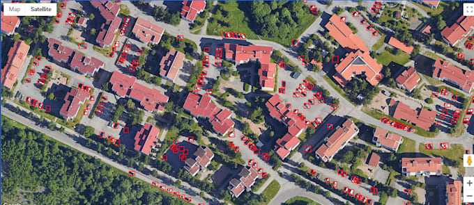
I provide expert analysis of satellite and aerial imagery utilizing sophisticated AI models to identify and examine specific items. I deliver precise data and perspectives from high-resolution satellite images, whether the requirement is counting vehicles in congested city locations, observing building development, or following shifts in the environment.
Main Offerings:
Identification of objects for diverse applications: automobiles, structures, vegetation, and others.
Examination of past images to detect changes across time.
Adaptable results, such as data summaries, online tools, and dynamic maps.
I access an extensive collection of satellite images from numerous worldwide periods, facilitating significant temporal evaluation. Allow me to assist in acquiring practical knowledge through advanced AI and accurate satellite information for well-grounded choices in undertakings.